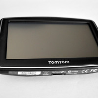
Only a few years ago, if you wondered where you were, you had to use maps and signs to find your current location. But due to developments in technology over the past few years, finding your current location has become quick and easy through the touch of a button. This is possible through the Global Positioning System, or better known as GPS.

The GPS is a network of satellites that are continually orbiting the earth. What we call a GPS is actually a GPS receiver, usually in the form of a hand-held or built in vehicular GPS tracker.
These receivers connect to the satellite network via radio signals and it is through their communication that the location of the receiver is determined.
When a handheld GPS receiver connects to the GPS network, it calculates its distance from each satellites in range. In order for the position of the receiver to be determined, the receiver must make a connection with at least 4 receivers at a time.
The satellites in space are orbiting in such a manner that at least 4 satellites will always be able to make a connection with any GPS receiver at any given time. When the GPS receiver makes a connection with a satellite, communication is opened between them and the distance from the satellite to the receiver is determined. Each satellite determines the distance from itself to the GPS receiver and gives a different distance measurement.
Each new measurement narrows down the possible locations where the receiver could be. Once it has three or four measurements, the geographical location is precise.
The distance between the satellite and the receiver is determined through a calculation made by the receiver. The receiver and the satellites run a pseudo-random code simultaneously. The satellites broadcast this code, and the receiver picks it up.
The code takes time to travel from space even at the speed of light, so the data lags behind the code running in the receiver. The receiver calculates the time discrepancy and can then determine the distance from the satellite.
With several measurements from different satellites, the receiver uses a mathematical process called triangulation to determine its precise geographical location.
Triangulation is easy to visualize in 2D space. If you have a piece of paper and you draw one circle, this represents one satellite. The edge of the circle represents the distance between the GPS receiver and the satellite. With only one distance known, the receiver could be anywhere along the edge of the circle.
Now draw another circle that overlaps the first circle. This second circle is a representation of the distance between the GPS receiver and a second satellite. Notice how there are only two points where the edge of both circles overlap. Those two points are now the only two possible locations where the GPS receiver could be located. Now if a third circle is drawn the location is now determined.
In the situation of a GPS, the third circle will overlap closely to one of the two possible locations. Thus the position is determined. This is how the satellites determine a receivers’ position. The distances from the 3 satellites are the three circles that all overlap at just one point. And the more satellites that are used, the more precise the location is.
It isn’t a perfect system, due to a number of factors that cause minimal errors, but GPS receivers continue to improve. What used to seem like such a baffling technology is now simple and easily understood. It’s not magic that your cell phone or vehicular GPS device knows your location, it is simple math and science.
